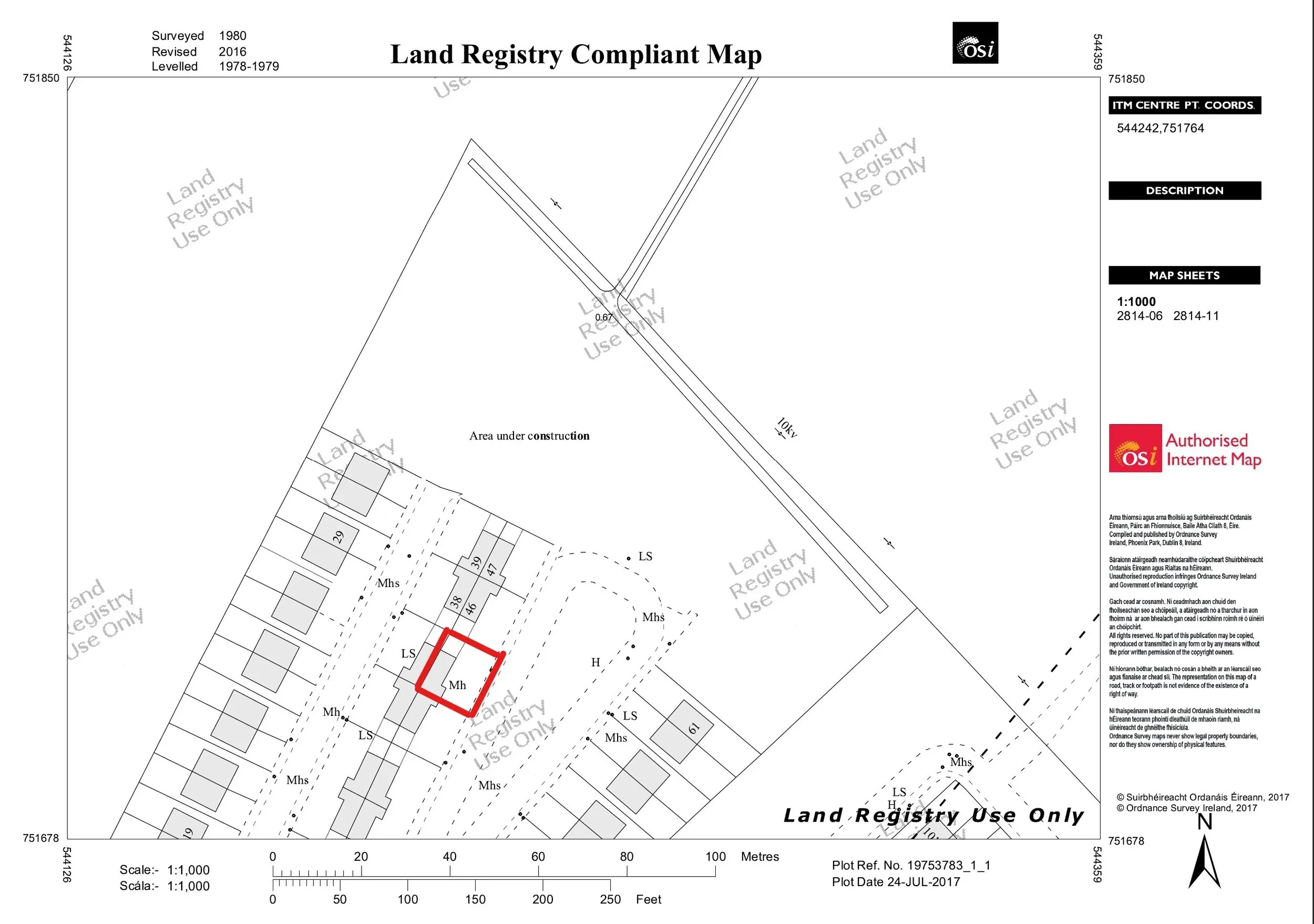
A fundamental starting point when buying a property in Ireland is getting the map and boundary checked. If the map is wrong, or the boundary is in the wrong place, it can be incredibly difficult to correct afterwards.
This map check can be done by hiring a registered Engineer, Architect or Property Surveyor to check the boundaries and registration maps.
In Ireland there were two main ways to register property or land ownership, as follows:
Land Registry: This is now operated by Tailte Éireann, which is an independent state agency responsible for property registration and national mapping. It was established on the 1/3/2023. It was previously known as the Property Registration Authority (PRA) or Land Registry. It is a register of maps that are kept to establish ownership. It is now the only way to register ownership of property in Ireland.
Registry of Deeds: This was established in March 1708, but it is no longer possible to register land in this way as this function has been taken over by Tailte Éireann and Land Registry. It was generally a descriptive register of land, often with no maps, to establish ownership. Mapping of land was generally commenced by Ordnance Survey after 1824. All transactions today, after 1/6/2011, must be carried out by Tailte Éireann and mapped on a Land Registry Compliant Map. So, the Registry of Deeds is now largely defunct.
How is the Land Registry Map Checked?
With the advent of technology, much of the country has been photographed with aerial photography. These images are very accurate and are used as the basis of a lot of mapping information.
When Land Registry maps are overlaid on these aerial images, discrepancies with the physical boundaries become apparent. These are then highlighted as part of your survey report.
Certain boundaries cannot be established, so they have to be reviewed physically on the ground. We undertake a walkover survey of the boundary in these areas and look for markers to define where the boundary should be, or should relate to.
In general, for a rural site, we will look at the immediate boundaries, subject to a maximum of 0.2ha or thereabouts. Discrepancies will be highlighted and then it is up to the Vendor to resolve the matter.
It is always advisable that a boundary be certified as correct with a “Declaration of Identity”, which is a sworn document from the Vendors engineer confirming that the boundary is correct.
In the case of more challenged topography, it may be advisable to retain a surveyor who utilises GPS or Total Station to electronically measure the boundaries, but this occurs in a minority of cases. We also offer recommendations in this regard after our initial survey.
What happens if the Vendor will not resolve a boundary issue?
Sometimes a Vendor may not agree that there is a discrepancy and be insistent that everything is in order. If this is the case, then you will be reliant on the Declaration of Identity that they have provided. If they have not provided any form of declaration, then we would advise that you proceed with caution.
Are there some map discrepancies that don’t matter?
Yes, there can be instances of where discrepancies don’t matter. In the case of where the registered boundary on the folio map is LARGER than the physical boundary on the ground. The technical ownership is larger, so any map discrepancy is outside the physical boundary and if this becomes an issue in the future, you can always do a voluntary transfer out of the folio map (with no impact on the physical boundary).
What about the planning map?
It is important to make sure that the planning map is substantially within the folio map. It does not have to perfectly match the boundary, it just has to be within the boundary you are purchasing. So, you can buy a property and also extra land around it if you wish, and there will be no issues with planning, provided the planning map is within the land you have purchased.
If a planning map is substantially outside the property you are buying, then there may be a planning problem. Such planning problems may require retention permission of the site on revised boundaries. These are usually technical applications only, aimed at resolving planning boundary issues.
Lastly, for rural sites that have septic tanks, it is important that you buy a minimum of 0.2ha (1/2 acre), as this is the technical minimum site required for a septic system. However, a grant of permission smaller than this size may negate any compliance issue in this regard, but this needs to be checked.
Is the map attached to the Registry of Deeds still important?
Yes. Whilst it will be ultimately superseded with the Land Registry Compliant Map for first registration, it is important that the deed map and first registration map be checked to ensure it was correctly transcribed.
However, there are limitations to the Deed map. Sometimes, it may just be a hand-drawn interpretation of the property and may have some imperial measurements on it. So, it can be difficult to be reliant on it. In such cases, only a visual comparison can be made.
What is a “notional boundary”?
A notional boundary is one that may not be physically defined. Sometimes, in housing estates, there can be common driveways at the front of the house with no fence or wall, and these are considered as notional boundaries.
What about boundaries on rough terrain?
It may not be practical to define a boundary on rough terrain, or steep inclines for practical purposes. These can be left regarded as notional or undefined as the cost to define them may outweigh the practicality of accessing them.
If you are buying a home in Galway or Mayo and need the map and boundary checked, it is important to retain someone who includes this as part of the service. At mypropertysurvey.ie we include this, as standard, in all our reports. Correcting boundary issues after you have bought a property can be a nightmare.