Unregistered Land: Why you need a “Land Registry Compliant Map” when selling your home in Galway or Mayo.
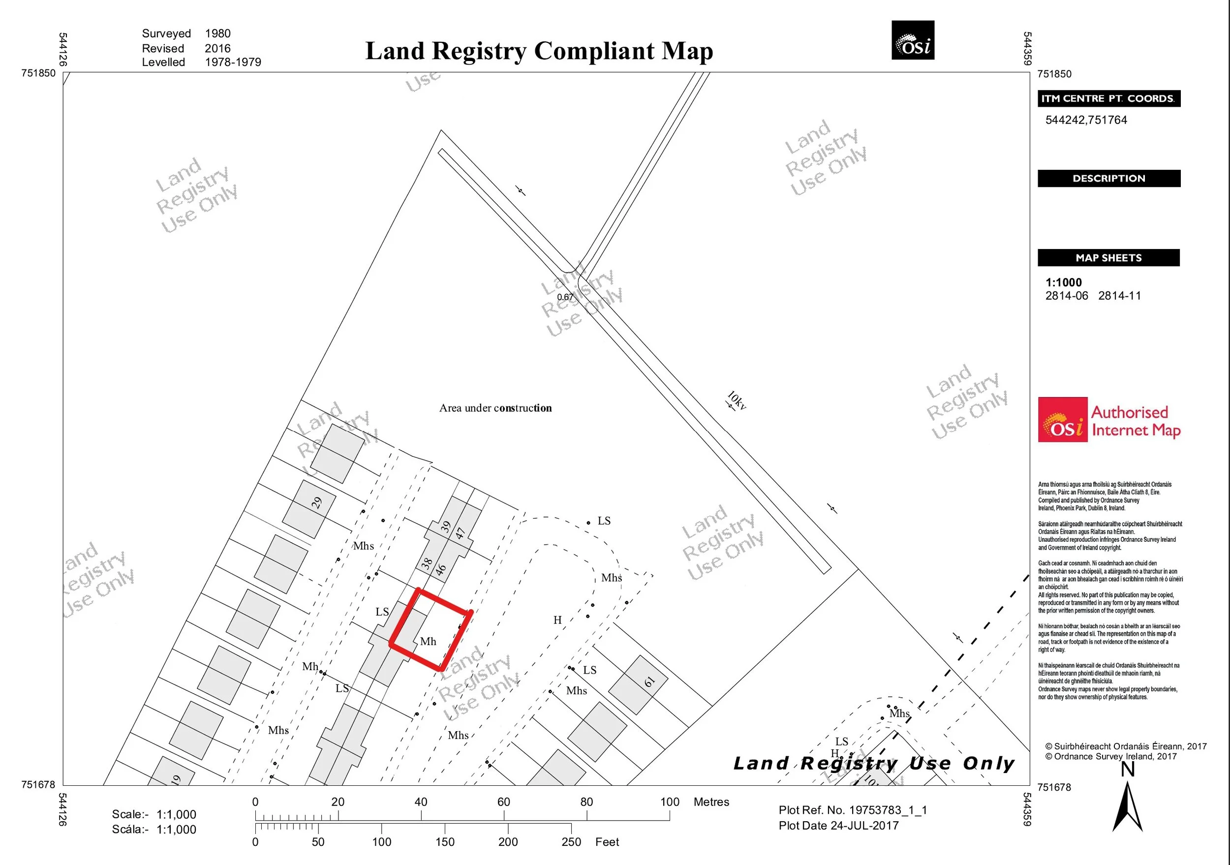
IMAGE: Land Registry Compliant Map for First Registration in Galway/Mayo
In Ireland if you are buying or selling land, you must provide an appropriate Land Registry Folio for the transaction. This folio contains the names of the owners and past owners of the land/property. The map attached to the folio is referred to as a ‘filed plan’. This is a map that contains the property, outlined usually in red. It also can contain leaseholds, which are outlined in green.
In Ireland there were two main ways to register property or land ownership, as follows:
Land Registry: This is now operated by Tailte Éireann, which is an independent state agency responsible for property registration and national mapping. It was established in the 1/3/2023. It was previously known as the Property Registration Authority (PRA) or Land Registry. It is a register of maps that are kept to establish ownership.
Registry of Deeds: This was established in March 1708, but it is no longer possible to register land in this way as this function has been taken over by Tailte Éireann. It was generally a descriptive register of land, often with no maps, to establish ownership. Mapping of land was generally commenced by Ordnance Survey after 1824. All transactions today, after 1/6/2011, must be carried out by Tailte Éireann and mapped on a Land Registry Compliant Map.
However, there are instances of land or property that is regarded as “unregistered land”, or land that may have been on the “Registry of Deeds”. If you are selling your house, it may have previously been recorded on the “Registry of Deeds”. If this is the case, it is now likely that your Solicitor has requested that you get an Engineer or Surveyor to prepare a “Land Registry Compliant Map”.
We have a special service for maps if you require same. The service is called mymaps.ie and it is also offered through My Engineer Ltd. So, if you are looking for First Registration Maps in Galway or Mayo, then we have you covered!
What is a Land Registry Compliant Map?
This is a special map that is prepared to record your current property holding and to present it on a map that is to the standards required by Tailte Éireann for registration. This process is also called “First Registration”. It is mandatory for all property transactions after 1/6/2011. Maps are prepared by registered Engineers or land Surveyors and they are put with all applications for first registration.
What is a Multi-Storey Map?
There are other instances where special maps are required for Apartment buildings or buildings that have multi-occupancy. These maps are called “Multi-Storey Maps”, and are a lot more complex than just a basic Land Registry Compliant Map. They require the internal space of an apartment or unit to be measured and presented on an ‘enlargement plan’. The plan is then marked with easting and northing coordinates to define where the space is on the ITM coordinate system.
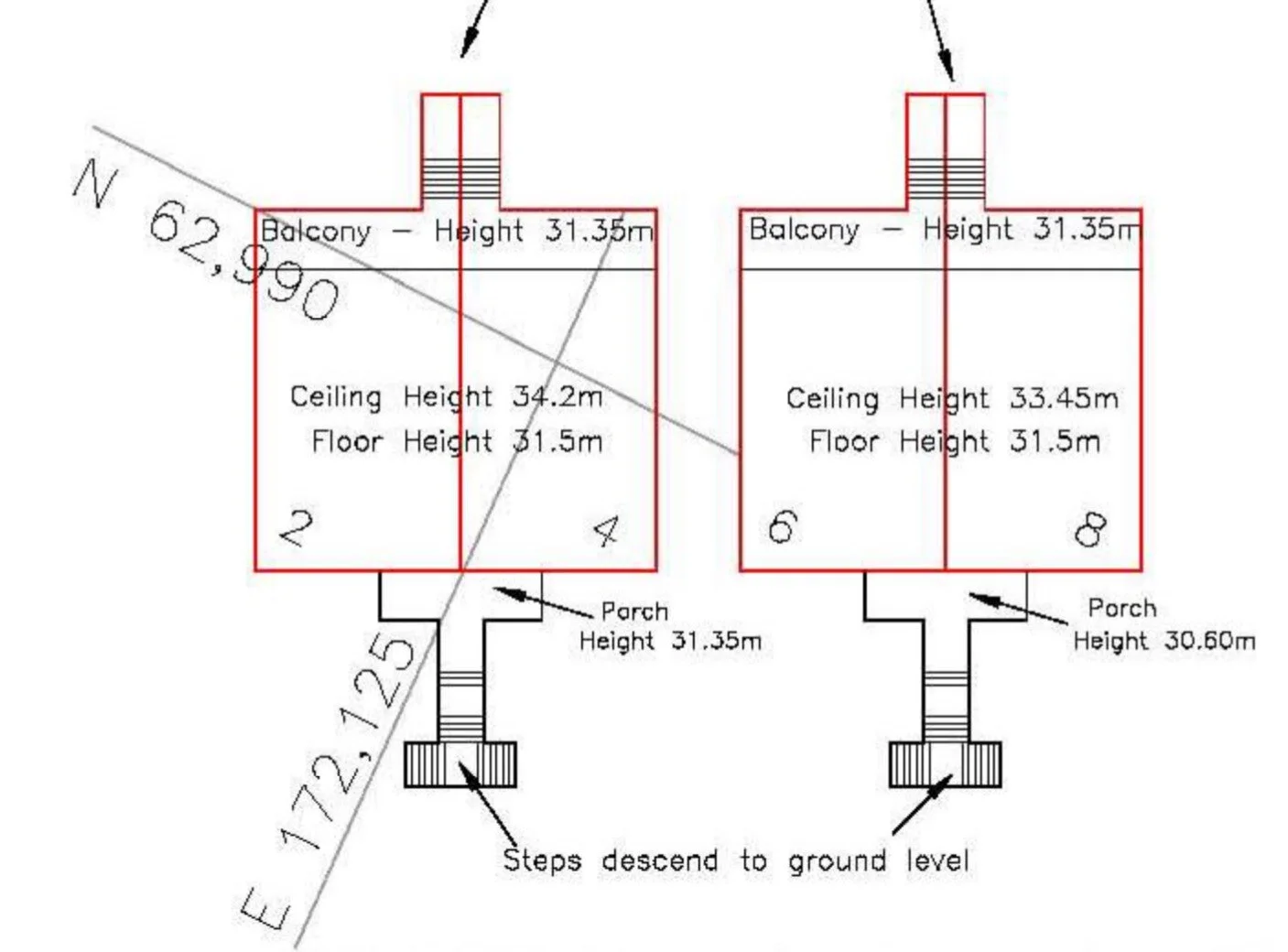
IMAGE: A typical enlargement plan for a multi-storey map in Galway / Mayo
What is a Declaration of Identity?
A Declaration of Identity is a sworn legal document or statement that is prepared by a qualified professional, such as an Engineer, Surveyor or Architect. The document usually states that the physical boundaries of the site match the boundaries on the Land Registry Map or Folio. It can also be used in cases where new maps are prepared for First Registration or Transfer.
The document is usually Sworn and Signed by the Engineer, Architect or Surveyor on front of a Commissioner for Oaths or a Solicitor. This Declaration of Identity is put with the title deeds of the property and used to verify that the site boundaries and maps are correct.
A Declaration of Identity can also be issued as a “Certificate of Identity”, especially if the Engineer/Architect or Surveyor is known to the Solicitor acting for the Client.